
Essential Guide to Drones in Central Suriname Nature Reserve
If you’re planning a trip to the stunning Central Suriname Nature Reserve (CSNR), one of the world’s largest protected areas, you might be considering bringing your drone. With sweeping rainforests, thundering waterfalls, and diverse wildlife, it’s obviously a picturesque scene just waiting to be captured from above. But before you pack your favorite flying gadget, let’s dive into everything you need to know about drones in this incredible locale. Whether you’re a seasoned drone pilot or a curious novice, I’m here to help you navigate the ins and outs of drone use in CSNR.
Why Use a Drone at CSNR?
Let’s be honest—exploring this reserve without aerial perspectives feels like missing out on a captivating story. Imagine gliding over the treetops, witnessing the lush greenery stretching endlessly, or catching sight of a meandering river from high above. Drones allow you to document the magical moments of your adventure in a way that traditional photography just can’t match.
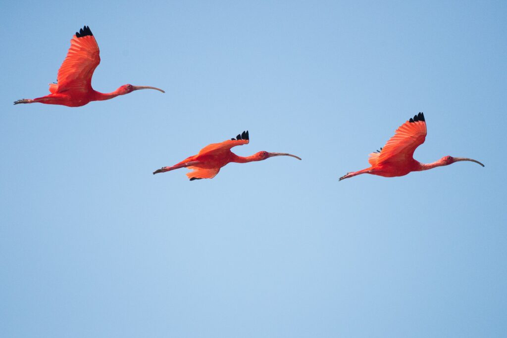
Moreover, the reserve is teeming with wildlife. From jaguars to colorful toucans, the fauna could literally be at your fingertips as you soar above. Just think about it: a breathtaking shot of a capybara from the air—priceless!
Knowing the Rules and Regulations
Before you unleash the full potential of your drone, it’s crucial to understand the regulations governing its use in Suriname. The law is quite strict, primarily aimed at preserving the delicate ecosystem. Failing to adhere to these guidelines could mean fines or, worse, having your drone confiscated.
- Permits Required: You’ll need a special permit to fly your drone in CSNR. It’s not just a formality—a way to ensure that flying doesn’t disturb the wildlife.
- Flight Restrictions: Certain areas within the reserve may be off-limits. This is often to protect sensitive habitats or bird nesting sites.
- Altitude Limits: Stay below a certain altitude (often around 120 meters or 400 feet) unless otherwise specified. Keeping it low not only protects wildlife but allows for better photos.
Responsible Drone Practices
Aerial photography can quickly become irresponsible if you’re not cautious. Here are some best practices to consider:
- Maintain Distance: Always keep a safe distance from wildlife. Getting too close can stress animals, especially in their natural habitat.
- Time Your Flights: Early mornings or late afternoons are optimal for capturing breathtaking scenery and wildlife activity—just keep the noise down!
- Battery Awareness: Keep an eye on your drone’s battery life, especially in remote areas. Getting stranded is no fun, trust me!
The Best Spots for Drone Photography in CSNR
If you’re eager to find the perfect locations to unveil the beauty of CSNR through your drone, here are a few must-visit spots:
1. The Tumuc-Humac Mountains
These majestic mountains offer an incredible backdrop for aerial shots. You can capture the dramatic ridges intertwined with verdant foliage—simply breathtaking! Make sure to plan your drone flights early to catch the sun rising over the peaks.
2. The Sipaliwini River
Flowing gracefully through the reserve, this river is a fantastic subject for overhead shots. A bird’s eye view reveals the way it winds through the dense rainforest, and possibly even some local wildlife along the banks!
3. Waterfalls of the Reserve
Several hidden waterfalls throughout CSNR are a joy to discover. Flying above them will not only make for stunning visuals but could also show how the water cascades into pools below. Bring extra batteries; you won’t want to miss capturing every angle!
4. The Wildlife Habitats
Without compromising safety, hover over the lush habitats where animals frequent. From howler monkeys to capuchin monkeys, you might catch a glimpse of them swinging through the trees or lounging in the sun.
Challenges You Might Face
Of course, it’s not all smooth sailing (or flying!). There are a few hurdles to keep in mind:
- Weather Conditions: Humidity and rain can be tricky to navigate. Always check the weather before your flight, as heavy rains may ground your plans.
- Drone Signal: Dense forests can sometimes interfere with your drone’s GPS signal. Familiarizing yourself with your controller will help, but don’t forget to keep the drone in sight and ready to land!
- Wildlife Interference: Sometimes the local critters can be unpredictable. If an animal seems curious or agitated by your drone, it’s best to respect their space and land.
Making the Most of Your Trip
It’s essential to plan ahead for a successful trip. Here’s a quick checklist to ensure that you’re ready:
- Obtain all the necessary permits before your trip.
- Research your drone model—know its strengths and weaknesses.
- Bring extra batteries and memory cards; you won’t want to run out while capturing amazing shots!
- Pack a mechanism to safely transport your drone, especially if you plan to hike to remote areas.
Lastly, and most importantly, soak up the experience. The stunning views, the sounds of the jungle, and the thrill of flying will create memories that last a lifetime. Plus, every click of your camera will capture a moment worth cherishing.
Now that you’re well-versed in the ins and outs of drone photography in the Central Suriname Nature Reserve, grab your gear and get ready for an unforgettable adventure. Don’t forget to respect the natural environment and its inhabitants—happy flying!
Related: For more tips on wildlife photography, check out National Geographic’s guide.
**Related Reading:** – [Related: How to Plan a Solo Trip on a Budget] – [Related: Top Destinations for First-Time Solo Travelers] **#SoloTravel #Essential #Guide #Drones #Central #Suriname #Nature #Reserve #Ultimate #Travel #Concerns #Answered**